
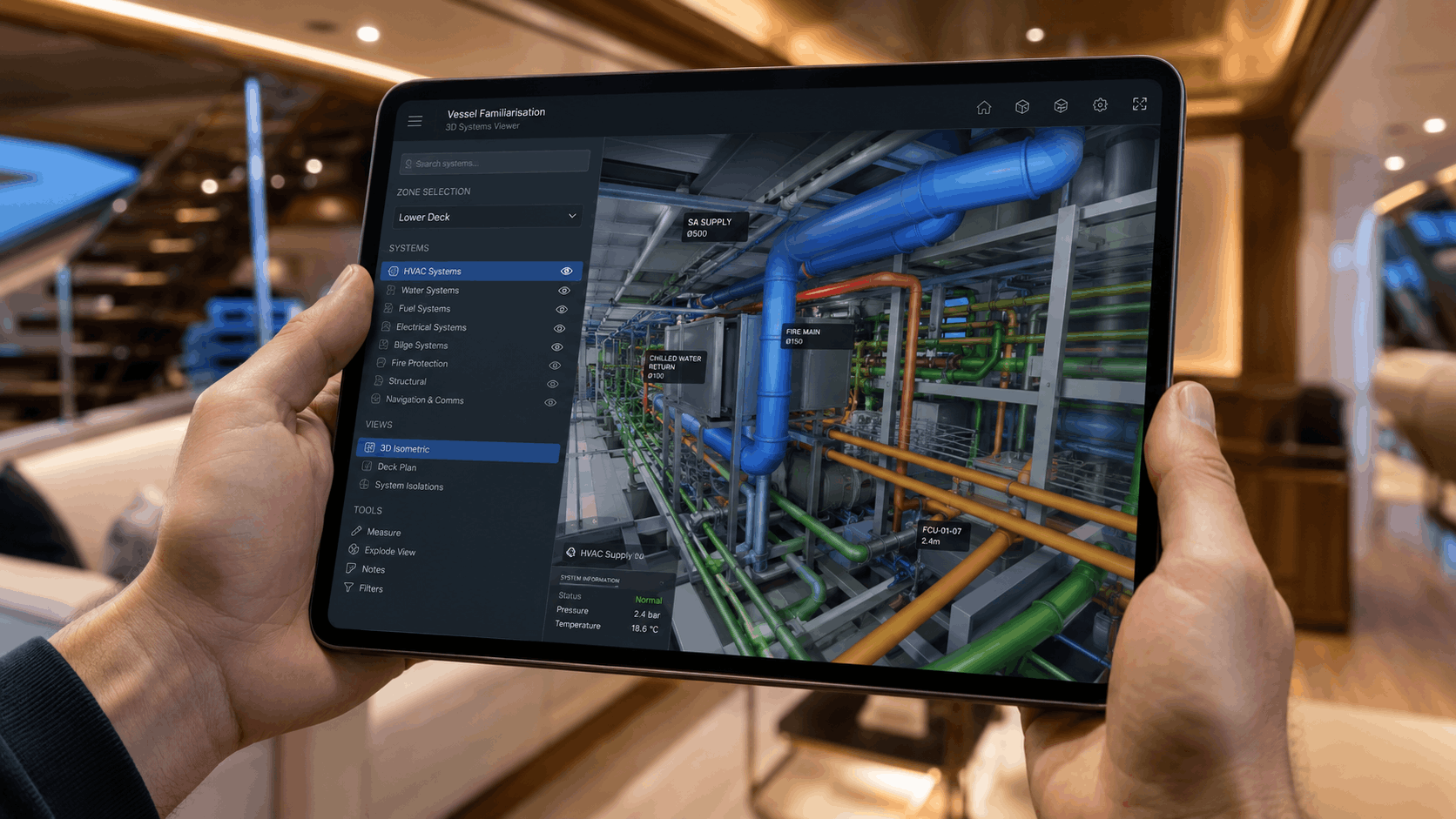
Rework is one of the most disruptive and expensive features of any superyacht refit.
A component does not fit the space allocated to it. A new pipe route clashes with an existing service. Access for installation is more restricted than expected. An interior panel has to be removed again because something behind it was not where the drawings suggested.
The immediate problem may appear to be fabrication, installation or coordination. In many cases, however, the real cause appeared much earlier in the project: the design was developed using incomplete, outdated or assumed dimensional information.
This is where 3D laser scanning can make a significant difference.
By capturing the yacht as it physically exists, rather than relying solely on historic drawings or manual measurements, laser scanning gives designers, shipyards, contractors and vessel teams a more dependable foundation for refit planning.
The value is not simply greater measurement accuracy. It is reduced uncertainty throughout the project.
Rework often begins with an assumption
Superyachts rarely remain exactly as they were originally designed.
Systems are modified, equipment is replaced, pipework is rerouted and interior spaces are altered. Even where good drawings were supplied at delivery, years of maintenance and upgrades can create a gap between the recorded vessel and its current condition.
That gap matters during a refit.
A designer may work from an original general arrangement drawing. A contractor may take a limited number of manual measurements during a short vessel visit. A supplier may quote based on photographs and dimensions provided by the crew.
Each party may be acting reasonably, but assumptions can begin to accumulate.
A measurement is taken between two visible surfaces without accounting for what sits behind them. A drawing shows a clear route that no longer exists. A piece of equipment fits within the available footprint but cannot physically be brought through the access route.
Individually, these may seem like small details. Once fabrication, procurement and scheduling have begun, they can become costly project problems.
What does 3D laser scanning provide?
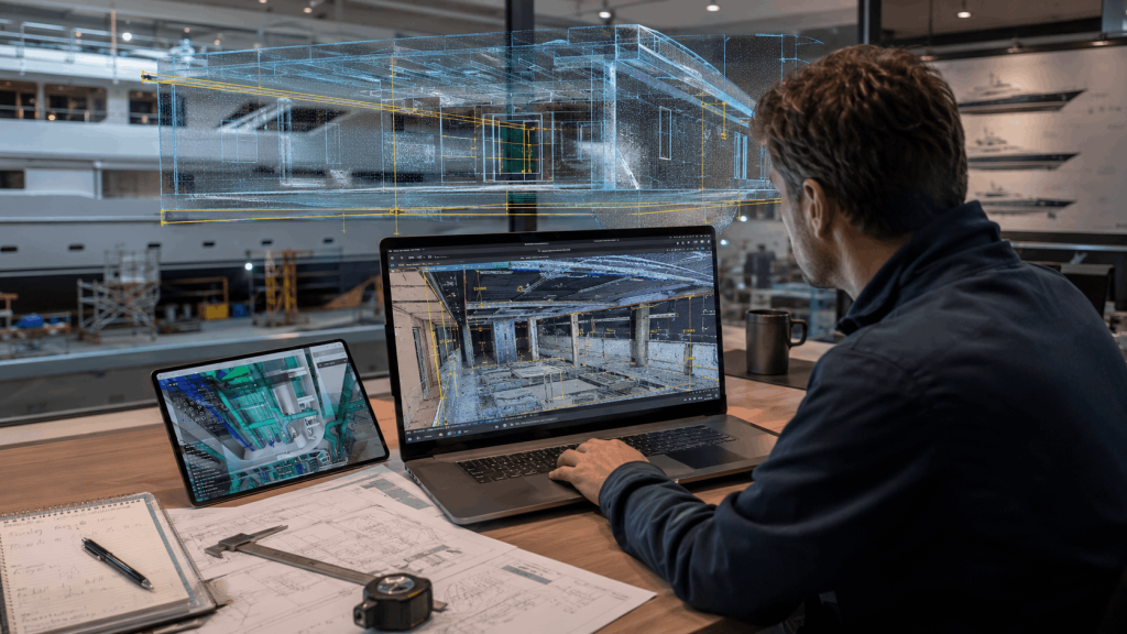
A 3D laser scanner captures a multitude of measurable points across the surfaces within its field of view. Each point has a position in three-dimensional space, creating what is known as a point cloud.
The resulting data forms a highly detailed digital record of the surveyed area. It can be viewed directly, measured remotely or converted into usable 2D drawings and 3D CAD models for designers, naval architects and engineering teams.
Sentini Marine’s scanning service, delivered with specialist partner Digital Dry Dock, can turn point cloud information into organised drawings and models for refit planning, reverse engineering, interior fit-out and component manufacture.
Instead of trying to reconstruct the yacht from several different sources, the project team can work from a shared representation of the vessel’s current geometry.
Verified data improves design accuracy
One of the clearest advantages of 3D laser scanning in a yacht refit is the ability to design against verified, as built conditions.
This is particularly valuable when planning work involving:
- Engine rooms and technical spaces
- Pipework, ducting and cable routes
- Interior joinery and furniture
- Equipment foundations
- Structural modifications
- Deck machinery and tender systems
- Legacy components that require replacement
- Restricted or irregularly shaped spaces
The design team can interrogate the scan, take additional measurements and review surrounding geometry without repeatedly returning to the vessel.
This does not remove the need for engineering judgement or onboard verification at critical stages. It does, however, reduce dependence on isolated measurements and assumptions made during a short survey visit.
Potential clashes can be identified earlier
A design can appear correct in isolation while still being incompatible with the space in which it must be installed.
New equipment may conflict with existing pipework. An access panel may not have enough clearance to open. A service route may pass through an existing structural element. A replacement component may fit in its final position but not through the companionway, hatch or machinery removal route.
When proposed designs are compared against point cloud data, these conflicts can be investigated before work reaches the fabrication or installation stage. Specialist modelling software can test design geometry against laser scanned point clouds to identify potential interferences earlier in the process.
Resolving a clash digitally is generally far less disruptive than discovering it after materials have been ordered, components manufactured and contractors mobilised.
More of the refit can be planned before the yacht arrives
Yard periods are valuable, tightly scheduled and frequently exposed to competing operational pressures.
When accurate scan data is available in advance, parts of the refit can begin while the yacht remains operational or is located elsewhere. Designers can develop proposals, yards can assess scope and suppliers can review spaces without every stakeholder needing immediate physical access to the vessel.
Digital Dry Dock describes using complete dimensional vessel surveys to allow shipyards to plan refit work remotely, including while a yacht remains on charter.
This creates an opportunity to move more decision-making away from the yard period itself.
The objective is not necessarily to eliminate onboard surveys. It is to ensure that time onboard is used for verification and final decisions rather than discovering basic spatial information that could have been captured earlier.
Better information can lead to better value quotations
The quality of information supplied during tendering has a direct effect on the confidence with which contractors can price the work.
Where dimensions, access requirements and existing conditions are unclear, suppliers must account for that uncertainty. This may result in:
- Additional contingency being included within the quotation
- Provisional allowances rather than confirmed costs
- Greater reliance on day rates
- Extensive exclusions and qualifications
- Additional survey visits
- Pricing based on worst case assumptions
A detailed scan does not guarantee that every refit package can be offered at a fixed price. Opening up work can still reveal corrosion, concealed damage or other conditions that no surface survey could reasonably identify.
However, verified dimensional data can remove a significant category of uncertainty.
When contractors can inspect the available space, measure interfaces, review access and coordinate their design against the existing vessel, they are in a stronger position to define their scope accurately.
That can support better value quotations and allow more elements of the project to be priced on a fixed price basis, where the work is sufficiently defined.
This benefits both sides. The owner receives greater cost clarity, while the supplier is less exposed to risks created by inaccurate information.
One shared reference improves coordination
Refits involve multiple parties, often working from different locations and using different technical systems.
The captain and engineering team understand the yacht operationally. The yard controls the project environment. Designers develop the proposed solution. Specialist subcontractors focus on individual packages. The management company or owner’s representative monitors programme, risk and cost.
Problems arise when each party is working from a different interpretation of the vessel.
A shared point cloud or 3D model can provide a common visual and dimensional reference. Questions can be discussed around the same information rather than through separate drawings, photographs and written descriptions.
Sentini positions its Reflection scanning service as a way for project teams, designers and owner representatives to work from verified vessel data, particularly when planning fit-out, routing and structural modifications.
This improves more than measurement. It improves communication.
How a small dimensional error becomes a larger refit problem
Consider a replacement item of technical equipment being installed within a machinery space.
The original drawing indicates sufficient room. Several manual measurements confirm the approximate dimensions, and the unit is ordered.
When it arrives, the team discovers that an existing pipe connection extends further into the space than recorded. The new equipment cannot be installed in its intended position without altering the pipe route.
That small difference can trigger a sequence of additional work:
The installation is paused. The pipework is redesigned. New materials are ordered. Another contractor is brought into the programme. Adjacent work is delayed. The equipment warranty or certification may need to be reconsidered following the design change.
The problem was not necessarily poor workmanship. It was a decision made without a complete picture of the existing space.
Capturing the area accurately before detailed design would have allowed the interface to be identified and resolved much earlier.
Laser scanning should happen before decisions become expensive
The timing of the survey is important.
Laser scanning delivers its greatest planning value when the information is available before detailed design, tendering and fabrication have progressed too far.
The project team should first identify which spaces, systems and interfaces are relevant to the proposed work. The scan can then be planned around the decisions that need to be made, rather than capturing data without a clear use.
It is also important to agree:
- The required survey coverage
- The level of detail needed
- The drawings or models to be produced
- The software formats required by project partners
- How the data will be accessed and managed
- Which dimensions or interfaces require additional verification
The purpose is not to create the largest possible dataset. It is to create reliable, usable information that supports the project.
A long-term asset beyond one refit
The value of scan data does not have to end when the current yard period finishes.
When properly organised and maintained, it can contribute to a wider digital record of the yacht. Future designers, engineers and project managers can return to the information when planning maintenance, replacements, upgrades or subsequent refits.
It can also support reverse engineering where original drawings are unavailable, help reproduce legacy components and provide a stronger visual reference for remote technical discussions.
The commercial case therefore extends beyond avoiding one piece of rework. It is about improving the quality of information available throughout the vessel’s operational life.
Reducing uncertainty before it reaches the yard
3D laser scanning should not be treated as a technology added to a project simply because it is available.
Its value is much more practical.
It gives refit teams a verified dimensional starting point. It allows designs to be assessed against real vessel geometry. It helps identify clashes and access problems earlier. It improves coordination between remote stakeholders and gives contractors stronger information against which to define and price their work.
Most importantly, it helps move uncertainty to a stage where it is still relatively inexpensive to resolve.
A few millimetres may appear insignificant during early planning. During fabrication and installation, they can become the difference between work fitting correctly and work having to be done again.
For owners, captains, management companies and shipyards, that makes accurate scan data more than a technical deliverable. It becomes a tool for achieving a more predictable, better planned and better value refit.
Sentini Marine provides 3D laser scanning and marine digital twin services through Reflection, helping superyacht teams plan refits, modifications and upgrades using verified vessel data rather than assumptions.
Leave a Reply